

Is Pollokshields rough, and is it safe? Police Scotland’s figures put the Pollokshields ward below the Glasgow average for recorded crime per resident, though above the Scottish one, and the biggest entries are shoplifting, drug possession and common assault without injury. It’s two areas with one name: Pollokshields East is Victorian tenements with the shops and food of Albert Drive, and Pollokshields West is big sandstone villas around Maxwell Park. Both are about two miles south-west of the city centre, with three train stations between them, and a one-bed in the G41 postcode averaged £928 a month in April to June 2026.
Last checked: 25 October 2026.
Where is Pollokshields, and where does it start and end?
Pollokshields is a Southside area about two miles south-west of Glasgow city centre, according to the council. It’s split in two. Pollokshields East is the tenement half, with shops and restaurants on Albert Drive, Nithsdale Road and Maxwell Road. Pollokshields West is the villa half, with Maxwell Park and its Burgh Hall.
Shields Road is where the two meet. It’s spelt Pollokshields, with a k. You’ll sometimes see Pollockshields with a c, but the council, National Rail and Glasgow Life all use the k.
We couldn’t find one official boundary round the whole of Pollokshields. On the maps in Understanding Glasgow’s profiles for Pollokshields East and Pollokshields West, which use boundaries based on a council mapping, Ibrox and Kingston are to the north, the Gorbals to the north-east, Govanhill to the east, Strathbungo, Shawlands, Langside and Battlefield to the south, and Pollokshaws, Bellahouston, Craigton and Mosspark to the south-west and west. The profiles count 8,842 people in the East and 7,297 in the West.

Is Pollokshields rough? Is it safe?
Folk ask partly because the two halves have different reputations. The West is thought of as the quiet, leafy half with the big houses, and the East as the busier one, with more flats and shops. The official figures don’t single either half out as a rough area, but they do show a mix, so here’s what they say and what they leave out.
What the deprivation index shows
The Scottish Government’s deprivation index, SIMD 2020, ranks every small area in Scotland from most to least deprived, 1 to 6,976. It’s still the latest edition, and it includes a crime measure.
The government splits Pollokshields into two zones, also called Pollokshields East and Pollokshields West, with six small areas each. It has a separate Maxwell Park zone with seven, which takes in the Burgh Hall and Maxwell Park station. That’s 19 small areas and about 15,500 residents (a 2017 estimate), and the table shows where they land.
| Government zone | Small areas | Most deprived fifth | Least deprived fifth |
|---|---|---|---|
| Pollokshields East | 6 | 0 | 0 |
| Pollokshields West | 6 | 2 | 1 |
| Maxwell Park | 7 | 0 | 2 |
| Glasgow City | 746 | 339 | 85 |
Source: Scottish Government, SIMD 2020v2 ranks, counted by us. Most deprived fifth means ranks 1 to 1,395 out of 6,976. Least deprived fifth means ranks 5,582 to 6,976, with 6,976 the least deprived.
So on paper Pollokshields is a lot less deprived than Glasgow as a whole. Two of its 19 small areas (11%) are in the most deprived fifth, against 45% of Glasgow’s, and three (16%) are in the least deprived fifth, against 11%. The East zone’s six small areas are ranked between 1,934th and 3,521st, so none is among the most deprived and none is among the least. The West zone has the widest spread, from 738th to 6,349th, partly because the government’s West zone takes in some flats and shops to the north as well as the villa streets. So the numbers don’t split neatly into a poorer East and a richer West.
Income, jobs, health and education make up 84% of the index while crime is just 5%, so it’s mostly a ranking of money and opportunity, not a verdict on the folk who live there. On the crime part, which uses 2017 to 2018 police data, none of the 19 small areas is in Scotland’s worst tenth, against 128 of Glasgow’s 746. Six of the 19 are in the worst fifth, against 271 of Glasgow’s 746.
What Police Scotland’s crime figures show
Police Scotland publishes recorded crime by council ward. Pollokshields is a ward in its own right, but it’s a lot bigger than the area in this guide: about 29,500 residents, including Dumbreck, Kingston, Craigton and parts of Shawlands and Strathbungo as well as Maxwell Park. In 2024-25 the ward had 2,134 recorded crimes, about 72 for every 1,000 residents, not counting the motoring, antisocial and miscellaneous offences that the Scottish Government counts separately. That compares with about 81 for Glasgow and about 54 for Scotland (our own sums, using National Records of Scotland’s mid-2024 population estimates), and seven of Glasgow’s 23 wards had a higher rate.
Glasgow had the highest rate of any council area in Scotland in 2024-25, so even an average Glasgow area sits above the national figure. A lot of what’s recorded is everyday stuff: the biggest entries were shoplifting (294), drug possession (275), common assault without injury (153), vandalism (134) and common assault on police officers and staff without injury (130). Serious assaults and robberies are a small part of it, with 8 and 6 in the whole year.
The number recorded dipped to 1,626 in 2021-22 and has risen each year since, to 2,134 in 2024-25. The ward’s population grew from about 28,200 in mid-2020 to about 29,500 in mid-2024. About half of the rise is shoplifting, which went from 34 recorded crimes in 2021-22 to 294 in 2024-25.
Police Scotland says these ward figures are provisional management information, not official statistics, and not directly comparable with them. The latest figures run to December 2025, and for April to December 2025 the order is the same: Pollokshields above Scotland and below Glasgow.
What the figures don’t show
- The index is old. Its crime figures are Police Scotland data for 2017 to 2018 and cover six types of recorded crime. A new edition was planned for the latter part of 2026, and we couldn’t find it published yet.
- The ward is bigger than Pollokshields. The police figures cover about 29,500 people, against about 16,100 in Understanding Glasgow’s Pollokshields East and West profiles together.
- They don’t show streets or times of day. The workbooks give crimes by ward and month, so they can’t tell you what one street is like, or what happens at different times of day.
So is Pollokshields safe?
Like the rest of Glasgow, it depends on the street and the time of day, and nobody can give you a simple yes or no. The figures say Pollokshields has less recorded crime per resident than the Glasgow average and more than the Scottish one, that most of its small areas sit in the middle of Scotland’s deprivation table, and that serious violence is a small part of what’s recorded. Use the same common sense you would anywhere in a city: lock your bike up, keep your phone out of sight late at night, and walk the street you’re thinking of moving to in the daytime and again in the evening before you sign anything.
Pollokshields East or West: what’s the difference?
Same name, different streets, and they were planned that way. In 1849 Sir John Maxwell of Nether Pollok had the architect David Rhind draw up a feuing plan, which is the layout for selling off building plots, for the farmland south of the old Glasgow, Paisley and Ardrossan Canal. It put villas on big plots in the west and tenements in the east. The council’s appraisals of East Pollokshields and West Pollokshields tell the story.
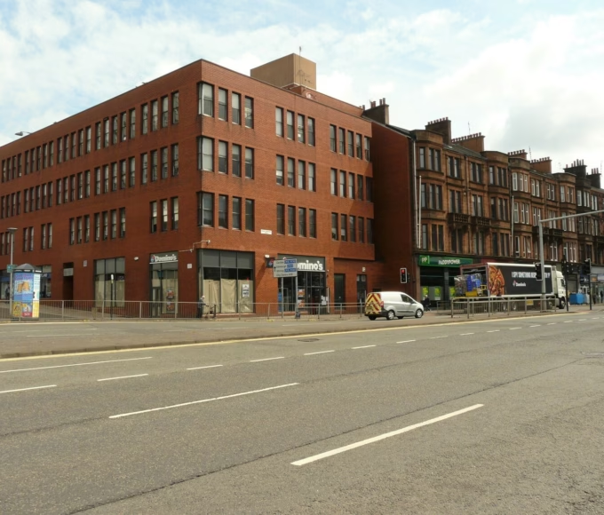
East Pollokshields is a grid of sandstone tenements, built mainly between 1855 and 1910 and kept to three storeys by the feu conditions. The council says the flats are generously proportioned, from three to seven rooms, and that every one had its own bath from the start, which was far from normal for Glasgow tenements. In the council’s words, its later blocks, mainly south and west of Nithsdale Road, are “some of the finest examples in existence anywhere in Scotland”. Shops, churches and schools were allowed here but generally not in the West, so the shops and food are mostly along Albert Drive, Nithsdale Road and Maxwell Road.
The council also says upkeep slipped after the war, when flats were sold off one by one and the old factoring system declined. Over the thirty years after 1962, improvement grants helped pay for stone cleaning, backcourt improvements and repairs, and the council says that brought interest back to the area. The appraisal was written in 2011 and approved in 2016, and it says many properties needed urgent or routine maintenance, so check the building and not just the flat.
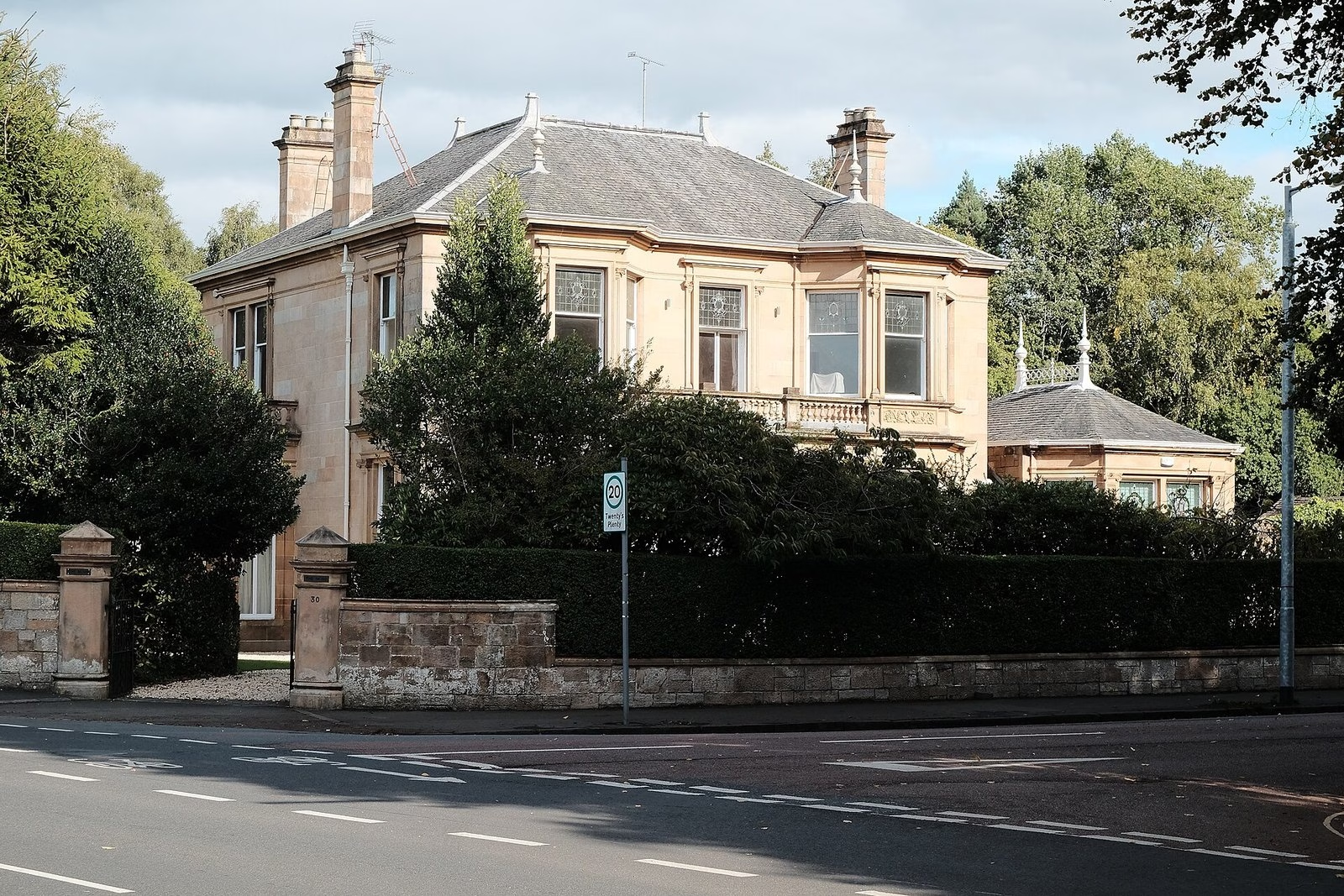
West Pollokshields is villas in their own grounds on wide, tree-lined streets. The council says about 400 villas had been built by 1890 and calls it “arguably Britain’s earliest planned garden suburb”. Shops weren’t part of the plan, so it’s quieter and more residential, with Maxwell Park as its main green space. Many of the villas that were split up over the years have since gone back to single homes.

The housing figures show the same split. They aren’t perfect, as the profiles’ boundaries don’t match the conservation areas exactly, but they give the picture.
| Measure | Pollokshields East | Pollokshields West | Glasgow |
|---|---|---|---|
| Homes lived in by their owners | 50% | 88% | 47% |
| Rented from the council or a housing association | 24% | 3% | 35% |
| Rented from a private landlord | 24% | 8% | 17% |
| Households with no car | 37% | 13% | 44% |
| Middle sale price, 2023 | £220,000 | £275,000 | £173,000 |
Households are from the 2022 Census, as counted in Understanding Glasgow’s profiles (a few households live rent free, so the tenure rows don’t add up to 100%). House prices are the Scottish Government’s figures for its Pollokshields East and Pollokshields West zones.
Both halves are conservation areas, designated in the 1970s. That means the council controls things like extensions, roof alterations, stone cleaning, painting the outside and satellite dishes, and the East appraisal also mentions extra controls on gates, fences and walls. Ask the council before you change anything on the outside.
Is Pollokshields a nice place to live?
There’s a lot going for it. The architecture is the headline, with the council calling the West “arguably Britain’s earliest planned garden suburb” and some of the East’s tenements among the finest in Scotland. Add Maxwell Park and a handful of smaller green spaces, a library, an arts centre, shops and food on Albert Drive and Nithsdale Road, and three train stations. You can rent a big tenement flat or buy a villa.
The less good bits are easy to list too. There’s no Subway station inside the area, none of the three train stations has step-free access to the platforms, the council’s 2011 appraisal calls daytime parking round the East’s shops “severely limited”, and evenings are low-key. Older tenements can need repairs, and being in a conservation area means some outside work needs planning permission.
Who’s it for? It suits renters and buyers who want a big Victorian flat with shops, food and a train station on the doorstep (the East), and buyers with a bigger budget who want a villa or a garden near a park (the West). It’s less of a fit if you want a big night out on the doorstep or a Subway station nearby. Our best areas to live in Glasgow guide compares the options by budget.
What’s Pollokshields like by day and at night?
By day the East is the busy bit. The council says its cafes, shops and restaurants sit on the ground floors of the tenements, for example on Maxwell Road and Albert Drive, with schools, nurseries, churches and a library mixed in. The West is residential, so it’s quiet and leafy. Pollokshields Library on Leslie Street is free to enter and open Monday to Saturday, until 8pm on Tuesdays and Thursdays.
Evenings are low-key and local. Desi Dhaba Chaiwala on Forth Street gives its hours as 10am to 10pm every day, and Tramway’s café bar closes half an hour before the building does, so by 5.30pm at the latest, though it may open later for performances and evening events. For a bigger night out you’ll probably head into town, or south to Shawlands.
Rent and house prices in Pollokshields
Citylets, which tracks Scottish rents, puts the average one-bed in G41 at £928 a month for April to June 2026, and the average two-bed at £1,078. G41 is Pollokshields’ postcode, but it also takes in Shawlands, Strathbungo, Dumbreck and Kinning Park, and Citylets doesn’t split out Pollokshields itself, so treat it as a guide. A one-bed is £16 above the Glasgow average of £912 and a two-bed is £133 below the £1,211 average. One-beds let in 18 days on average, against 26 across Glasgow, and two-beds in 36 days, against 32.
| Postcode | Area | One-bed | Two-bed |
|---|---|---|---|
| G41 | Pollokshields, Shawlands, Strathbungo, Dumbreck and Kinning Park | £928 | £1,078 |
| G42 | Govanhill, Crosshill, Mount Florida and Battlefield | £813 | No figure |
| All Glasgow | £912 | £1,211 |
Average monthly rent, April to June 2026. Source: Citylets.
Our guide to renting in Glasgow covers deposits and your rights. Before you sign, you can also search the Scottish landlord register to check that a landlord is registered and see who manages the property (you’ll need the registration number or the property’s postcode).
Buying a home
The latest small-area house price figures we found are for 2023. That year the middle price (the median) for a home sold in Pollokshields East was £220,000, from 127 sales, and in Pollokshields West it was £275,000, from 70 sales. The middle price across Glasgow was £173,000. A quarter of the homes sold in Pollokshields West went for more than £447,625.
| 2023 sales | Middle price | A quarter sold for more than | Sales |
|---|---|---|---|
| Pollokshields East | £220,000 | £270,000 | 127 |
| Pollokshields West | £275,000 | £447,625 | 70 |
| Maxwell Park | £347,222 | £446,633 | 102 |
| Glasgow City | £173,000 | £245,000 | 10,464 |
Source: Scottish Government residential property sales and prices, for its Pollokshields East, Pollokshields West and Maxwell Park zones.
For something more recent, the UK House Price Index put the Glasgow average at £194,382 in August 2026, up 1.8% on a year earlier. If you’re buying a tenement flat, get a proper survey and ask whether the close has a property factor, a maintenance plan and building insurance. Check sold prices on ScotLIS before you make an offer.
Where to eat, drink and browse
Albert Drive, Forth Street, Nithsdale Road and Maxwell Road are where the food and shops are, and the food hygiene register lists plenty of grocers, bakers, sweet shops and takeaways along Albert Drive. We checked each place below against its own website or the register in October 2026.
- Ambala (11 Forth Street) is a family-run Pakistani and Indian restaurant that says it was established in 1984. Its website gives its hours as noon to midnight in one place and 12.30pm to 10pm in another, so check before you go. The menu has curries and biryanis, grills, pizzas and burgers, and it names Lahori chaska karahi, mixed grill and house-made kulfi falooda as its specialities.
- Desi Dhaba Chaiwala (21 Forth Street) lists desi breakfast all day, parathas, thalis and chai, and gives its hours as 10am to 10pm every day.
- Tramway’s café bar (25 Albert Drive) does sandwiches, soups, cakes and hot and cold drinks. The building’s standard hours are Wednesday to Friday and Sunday 11am to 5pm and Saturday 11am to 6pm, and the café bar closes half an hour earlier.
- Moss Coffee House (10 Albert Drive), The Grind House (184 Darnley Street) and Dawat (253 Maxwell Road) are three more cafes and restaurants. The food hygiene register shows Moss Coffee House was inspected on 17 July 2026, The Grind House on 23 July 2026 and Dawat on 14 September 2026, and all three passed.
Getting around: trains, the Subway and buses
Trains
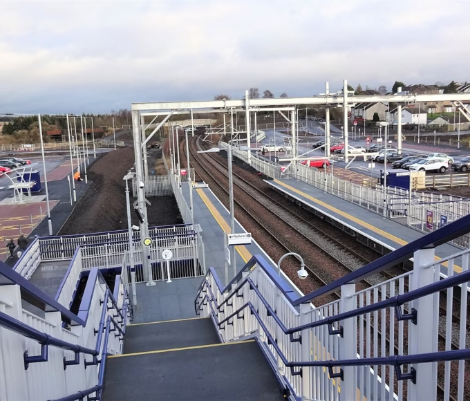
Pollokshields has three stations: Pollokshields East on Albert Drive (G41 2NE), Pollokshields West on Darnley Road (G41 5HT) and Maxwell Park on Fotheringay Road (G41 4DT). ScotRail manages all three. National Rail says each has ticket machines and bike storage, none has a car park (Pollokshields West has one accessible space), and none has step-free access to the platforms.
They’re on ScotRail’s Cathcart Circle lines into Glasgow Central. We couldn’t open ScotRail’s current timetable, so check it for times and frequency before you plan a commute. Our Glasgow trains guide covers fares and the Zonecard.
Subway
There’s no Subway station in Pollokshields. The nearest are Shields Road (360 Scotland Street) and West Street, both about half a mile north of the two Pollokshields train stations in a straight line, and Kinning Park, which is about a mile from Maxwell Park station. Tramway says it’s an 18 minute walk from its building on Albert Drive to West Street. SPT says the Subway runs from 6.30am to 11.40pm Monday to Saturday and 10am to 6.12pm on Sundays, and there’s parking at Shields Road. Our Glasgow Subway guide has the route and fares.
Buses
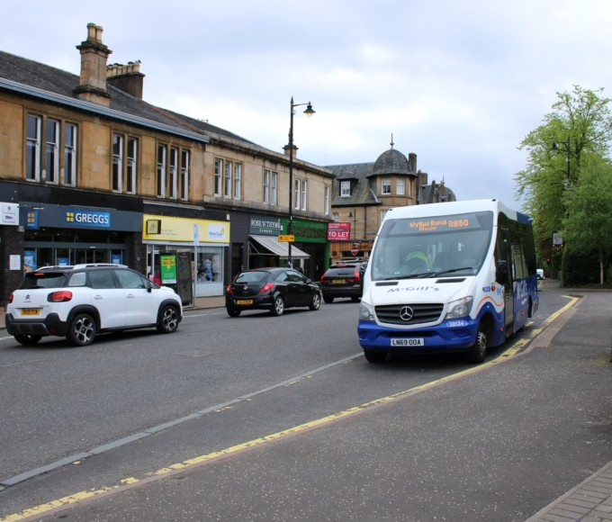
Pollokshaws Road, on the eastern edge, is the busy bus corridor. First Glasgow’s 3, 38 and 57, McGill’s 3 and 59 and Stagecoach’s 4 all call there. Counting the departures for Tuesday 27 October 2026 in the Bus Open Data Service timetables, about 23 buses an hour stop at the Albert Drive stop on Pollokshaws Road, heading for the city centre, between 9am and 3pm.
Inside the area, First’s 90 is a long cross-city route from Partick to the QEUH hospital, via Maryhill, Springburn, Parkhead, Rutherglen, Shawlands, Pollokshields and Govan. On weekdays it runs about every half hour from around 6.30am until the early evening, with the last journey around 7.20pm. McGill’s 59 runs roughly hourly between Mosspark and the city centre via Dumbreck and Pollokshields.
Things to do in Pollokshields
Tramway at 25 Albert Drive is a centre for contemporary art and performance. Its standard hours are Wednesday to Sunday from 11am, with the galleries opening at noon. Harold Offeh’s exhibition The Mothership Collective 2:0 runs until 7 February 2027, and Hanna Tuulikki’s performance Deer Dancer is on 28 November.
The Hidden Gardens (25a Albert Drive) is a free urban garden run by an independent charity. Its April to October hours are Tuesday to Friday 10am to 5pm and Saturday and Sunday 11am to 5pm, closed Mondays, so check its site for winter hours. Only assistance dogs are allowed, and you can bring a picnic.
Maxwell Park is in the heart of West Pollokshields. The council says it has a children’s play area, bedding displays and grass, and its appraisal says Sir John Stirling Maxwell gave the land to the burgh in 1888 and the park opened in 1890. Titwood Park, a small wooded park with play facilities, is slightly further east along Terregles Avenue. In the East, the council says Maxwell Square, which opened in 1889, is the main public green space.

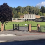
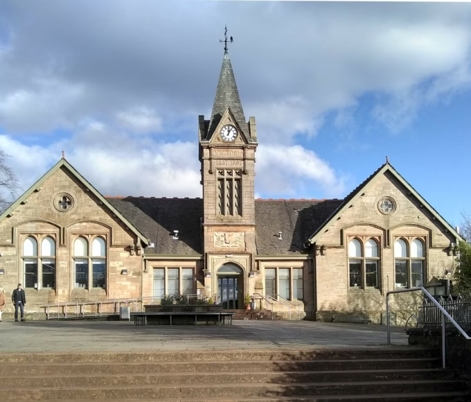
Pollokshields Burgh Hall (70 Glencairn Drive), at the eastern edge of Maxwell Park, is Category A listed. Historic Environment Scotland dates it to 1888 to 1890 and credits H E Clifford. A new trust bought it for £1 in 1991 and reopened it in 1996 after a big restoration. It’s mainly a hire venue and community hall, so check the Trust’s site for what’s on.
The architecture is a good enough reason for a wander. The council says the block where Kenmure Street, Nithsdale Road and Darnley Street meet was designed by Alexander “Greek” Thomson, with work starting in 1873 and finished by his partner Robert Turnbull in 1888, and that the church spires on Albert Drive are landmarks on the skyline.
Further out, House for an Art Lover in Bellahouston Park was built in the 1990s from Charles Rennie Mackintosh’s 1901 designs and has a café open 10am to 5pm every day. It’s about a mile and a half west of Pollokshields West station in a straight line. The Burrell Collection in Pollok Country Park is free to enter and about a mile from Maxwell Park station.
Schools and families
Which school your child gets depends on your address, so check before you rent or buy, and see our school catchment and placing requests guide. The council lists Pollokshields Primary (241 Albert Drive) and Glendale Primary (120 McCulloch Street) as non-denominational primaries in the Govan and Bellahouston learning community. Glendale Gaelic Primary, a Gaelic-medium school, is at 2 Kenmure Street, and St Albert’s Primary (36 Maxwell Drive) is Roman Catholic.
Bellahouston Academy (30 Gower Terrace), a non-denominational secondary, is in the same learning community. Hutchesons’ Grammar School, an independent school, has its secondary site at 21 Beaton Road. For nurseries, childminders and out of school care, the council’s Glasgow Families Information Services website has a search tool.
Parking
More households in the East are without a car: 37% have none, against 13% in the West and 44% across Glasgow in the 2022 Census. That doesn’t mean parking’s easy. The council’s appraisal of East Pollokshields, written in 2011, says short-term daytime parking round Albert Drive and Nithsdale Road is “severely limited”. The council listed Pollokshields among the areas it was considering for parking controls in 2026/27, with no published scheme in the January 2026 copy we saw. That page has since come down, so check the council’s parking pages before you rent or buy.
Pollokshields questions answered
Is Pollokshields rough?
The official figures don’t single it out as rough, but they do show a mix. The Pollokshields ward had about 72 recorded crimes for every 1,000 residents in 2024-25, below Glasgow’s 81 and above Scotland’s 54, and most of its small areas sit in the middle of Scotland’s deprivation table. Two small areas are in the most deprived fifth, so it isn’t the same everywhere.
Is Pollokshields safe?
It depends on the street and the time of day, like anywhere in Glasgow. Serious assaults and robberies were a small part of the ward’s recorded crime in 2024-25, at 8 and 6 for the year, while shoplifting (294) and drug possession (275) were the biggest entries.
Is Pollokshields a nice place to live?
There’s a lot going for it. It has Victorian tenements and villas in two conservation areas, parks, a library, an arts centre, shops and food, and three train stations. The East is busier and the West is quieter, so go and look at both.
What’s the difference between Pollokshields East and West?
The East is a grid of three-storey sandstone tenements with the shops and food, and the West is villas in their own grounds around Maxwell Park. About half the homes in the East are lived in by their owners, against nearly nine in ten in the West.
What postcode is Pollokshields?
G41, which also takes in Shawlands, Strathbungo, Dumbreck and Kinning Park.
Is there a Subway station in Pollokshields?
No. The nearest are Shields Road and West Street, about half a mile north of the two Pollokshields train stations in a straight line. Pollokshields East, Pollokshields West and Maxwell Park have trains to Glasgow Central.
How much is rent in Pollokshields?
Citylets puts the average one-bed in G41 at £928 a month for April to June 2026, and the average two-bed at £1,078. G41 covers more than Pollokshields, so treat it as a guide.
The verdict: is Pollokshields worth a look?
On the official figures Pollokshields comes out better than Glasgow as a whole: less recorded crime per resident than the city average, and far fewer of its small areas in the most deprived fifth. It isn’t the same everywhere, though. Two small areas are in Scotland’s most deprived fifth, recorded crime in the ward has risen since 2021-22, and the older tenements need a proper look before you rent or buy.
What you get is two very different places for the price of one name. The East has big Victorian flats, shops and food on the doorstep and a station, and the West has villas, gardens and Maxwell Park. Go and see the street you’re after in daylight and again in the evening, ask about repairs and the factor, and make up your own mind. If you want more going on at night, Shawlands is just to the south.
Written by Lewis McGuire.